
 Grade 10
 Prosiana, Pokrovskyi District, Dnipropetrovska Oblast
Schedule
The photo shows a graph illustrating the operation of my invention.
Sign in to join the conversation.
Anyone can like; writing a comment takes a UKRIC account.
Sign in
Mobi Road Scan — an autonomous IoT device for $55. It scans potholes at 50 m, filters out false signals using an accelerometer, and warns drivers in the app 500 m in advance.
Every day, millions of drivers face the same problem — sudden deep potholes, open manholes, construction debris or unexpected obstacles on the road can seriously damage the suspension, puncture a tire or even cause an accident within seconds. Traditional navigators most often rely on outdated user-submitted markers, and utility services do not have time to promptly respond to all road surface damage. This problem is especially acute on suburban and rural roads, where high driving speeds combine with poor visibility and lack of quality pavement. That is why I am creating Mobi Road Scan — an innovative, affordable and fully autonomous IoT system for predictive traffic safety. Who this will help: Ordinary drivers: saves the suspension, wheels and nerves, giving precious seconds for a safe maneuver or braking. Passenger and commercial vehicles (taxis, couriers, buses): reduces the cost of constant repairs and ensures transportation safety. Road and utility services: forms an up-to-date digital map of pavement defects for prompt repair.
Roads change every day, but with my invention, drivers will always be one step ahead of danger.
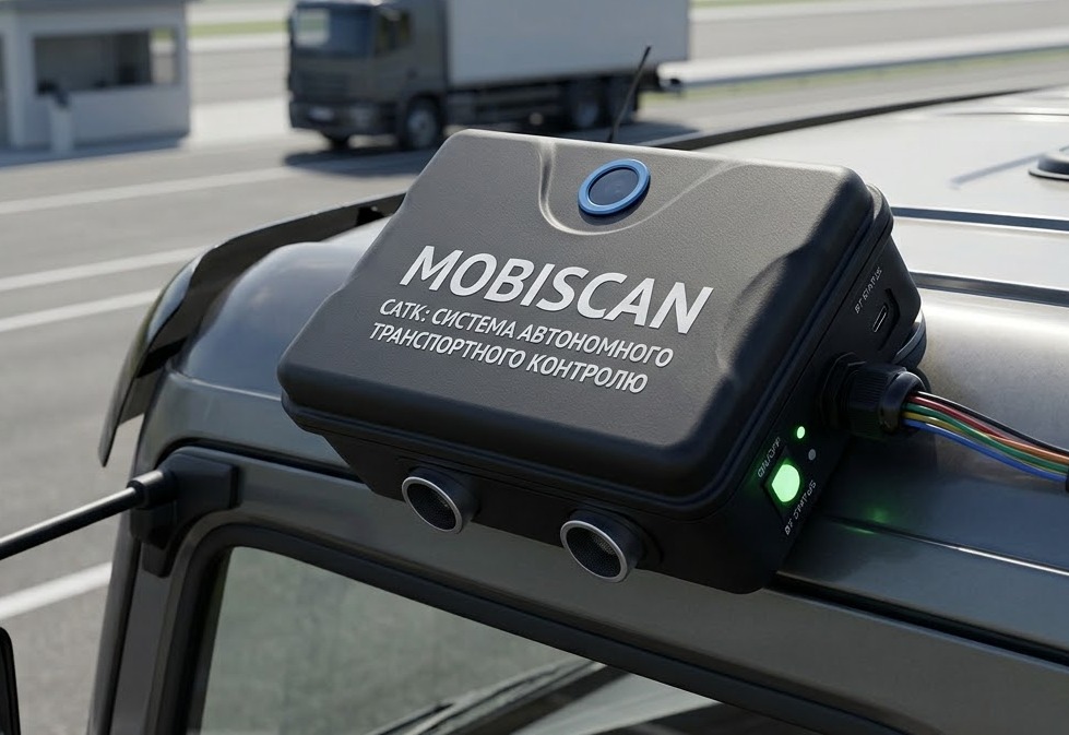
— Максим ЛихінMobi Road Scan is an autonomous IoT system for real-time road surface scanning. The device detects potholes and bumps, helping to build a safety map for drivers. The hardware is based on an ESP32 microcontroller, which combines several key sensors. The AirSelfie R50-C optical dToF rangefinder scans the road surface at a distance of up to 50 meters, the MPU-6050 inertial module measures overloads to confirm suspension impact, and the GPS module is responsible for precise coordinates. The system is powered by a battery with up to 8 hours of autonomy and is mounted in a compact IP65 enclosure. Special algorithms filter out noise from ordinary asphalt vibrations, and the collected data is transmitted to the cloud via MQTT/REST API. The server side processes the information using crowdsourcing: once defects are confirmed by several devices, the marker is considered a verified hazard. The mobile app displays an interactive map and warns the driver of road damage in advance with an audio signal. My project is new because I combined an invention with an app that will collect data from most locations in the world to understand the situation with roads and their safety. Mobi Road Scan is unique in combining price (~$60) and automation. Unlike manual apps (Waze), it scans potholes on its own. Unlike expensive lidars (Tesla), it is an affordable IoT module based on ESP32. And thanks to dual-circuit filtering (dToF + MPU-6050), false positives are completely eliminated, creating a single
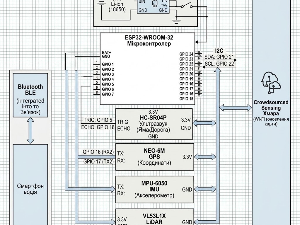
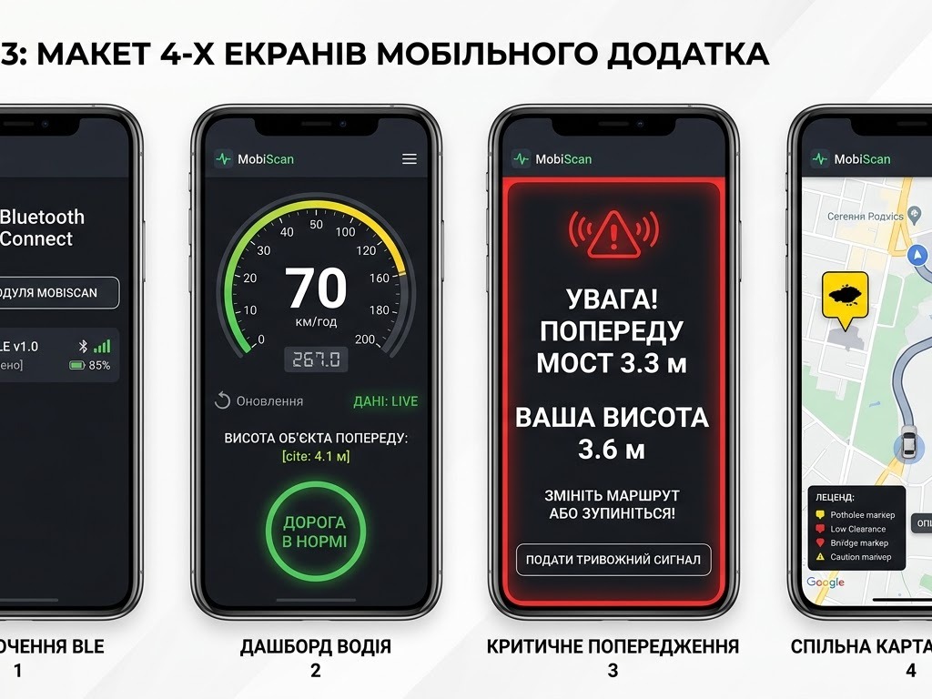
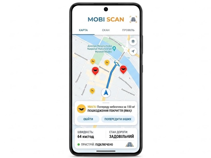
The photo shows a graph illustrating the operation of my invention.
I conducted an analysis of existing solutions for road monitoring:
Mobile applications (Waze): Require manual driver distraction to mark potholes. Mobi Road Scan operates 100% automatically thanks to dToF and MPU-6050.
Commercial LiDAR systems (Tesla, RoadBotics): Cost thousands of dollars and are
I did not perform bridge measurements via the sensor, because the main task of the device is to look ahead on the road and detect potholes and obstacles, while bridges can already be monitored through GPS and the cloud map; and in future versions I plan to add artificial intelligence for better
Integration of the high-speed OEM module AirSelfie R50-C (UAV dToF) with an operating range of up to 50 meters and a 100 Hz refresh rate.
Main sensor: The high-speed UAV dToF module AirSelfie R50-C was selected (range up to 50 m, frequency 100 Hz).
Reaction time: At a speed of 60 km/h, 50 meters
I performed calculations of motion physics and driver reaction time: at a speed of 60 km/h, a car covers ~16.6 m/s. To ensure ~20 seconds of advance warning about an obstacle (logs, rocks, potholes), a detection range of over 80 meters is required.
As a result of the analysis, I decided to modify
If you have an idea to solve a real problem in your community, we want to hear from you.

Access your inventor profile and track your application.
Enter the email you signed up with. We'll send a link to set a new password.
We sent a reset link to you@example.com.
It expires in 60 minutes. If it's not there, check your spam folder.
Choose a new password for you@example.com.
This password reset link has expired or was already used. Request a fresh one and try again.

0 comments.
Sign in to join the conversation.